Letca
| Letca | |
|---|---|
| Commune | |
|
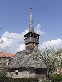
Wooden Church in Letca | |
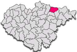
 Letca in Sălaj County | |
 Letca Letca within Romania | |
| Coordinates: 47°20′04″N 23°27′18″E / 47.33444°N 23.45500°E | |
| Country |
|
| County |
|
| Commune | Letca |
| Historic region | Transylvania |
| Government | |
| • Mayor | Petru Cozma (Democratic Liberal Party) |
| Area | 60.50 km2 (23.36 sq mi) |
| Population (2002)[1] | 2,244 |
| Time zone | EET (UTC+2) |
| • Summer (DST) | EEST (UTC+3) |
| Website | www.comunaletca.ro |
Letca (Hungarian: Létka) is a commune located in Sălaj County, Romania. It is composed of nine villages: Ciula (Gyulaszeg), Cuciulat (Kocsoládfalva), Cozla (Kecskés), Letca, Lemniu (Lemény), Purcăreţ (Pórkerec), Şoimuşeni (Kővársolymos), Topliţa (Szamoshéviz) and Vălişoara (Dióspatak).
Villages
Purcăreţ village had 139 inhabitants at the 2002 census. It is located on the right bank of the Someș River, and borders Maramureș County. It is first attested in a document of 1543, referred to as Porkerecz. Other documents refer to it as Porkoricza (1553), Pwrkerecz, Purkerech (1566), Purkeritz (1733), Porkeresty (1750), Purkeretz (1760-1762), Purkuretz (1830), Purkuretzi (1850), Purkerecz, Purcureţi (1854), and finally Purcăreț (1966).[2] The noble family Lazăr of Purcăreț originates from this village.[3] The Wooden Church from Purcăreț is traditionally dated from 1698, although the Culture Ministry cites 1740 and researcher Ioana Cristache-Panait says it is from the first half of the 19th century.
Sights
- Wooden Church “St. Mary” in Letca, built in the 17th century (1665), historic monument
- Wooden Church “St. Archangels” in Letca, built in the 18th century, historic monument
- Wooden Church in Purcăreţ, built in the 19th century, historic monument
- Wooden Church in Şoimuşeni, built in the 19th century, historic monument
- Wooden Church in Topliţa, built in the 19th century (1864), historic monument
Images gallery
 Wooden church in Cuciulat
 Wooden church in Șoimușeni
 Wooden church in Purcăreț
 Wooden church in Toplița
Coordinates: 47°20′N 23°27′E / 47.333°N 23.450°E
References
- ↑ Romanian census data, 2002; retrieved on March 1, 2010
- ↑ Chendre-Roman, Gheorghe. Dicţionar etimologic al localităţilor din judeţul Sălaj. Editura Silvana, Editura Caiete Silvane, 2006, ISBN 973-7817-41-9
- ↑ National Archives of Romania, Sălaj County Branch, Lazăr of Purcăreț family fund, inventory number 131 (1720-1945)

