Lammermuir Hills


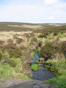
The Lammermuirs (An Lomair Mòr in Gaelic) are a range of hills in southern Scotland, forming a natural boundary between Lothian and the Borders. The name literally means "lambs' moor".[1][2][3][4] Early forms include Lombormore, Lambremore, Lambermora and Lambirmor.
Spanning the counties of Selkirk, East Lothian, and Berwick, the Lammermuirs extend from the Gala Water to St Abb's Head, and offer a traditional site for sheep grazing. The hills are nowhere especially high, the highest points being Meikle Says Law at 535 m (1,755 ft) and the Lammer Law at 528 m (1,732 ft); but steep gradients, exposure to the elements, and a lack of natural passes combine to form a formidable barrier to communications between Edinburgh and the Borders.
The hills are crossed by only one major road (the A68), which crosses the shoulder of Soutra Hill between Lauder and Pathhead, and is frequently closed by snow in winter. The main road linking Edinburgh to England (the A1) avoids the hills by following a circuitous route around the coast.
White Castle was an Iron Age hill fort, settled by the ancestors of the Votadini tribe.
Two ranges of hills in New Zealand, the Lammermoors and Lammerlaws are named after the Scottish hills.
Sir Walter Scott's novel The Bride of Lammermoor is set here. Scott lived at Abbotsford House, near Galashiels.
See also
- List of places in East Lothian
- List of places in the Scottish Borders
- Marilyns in the area
- List of places in Scotland
References
- ↑ http://www.scotways.com/scotways_assets/files/045_lammermuirs_map.pdf
- ↑ http://answers.encyclopedia.com/question/does-name-lammermuir-hills-originate-761340.html
- ↑ Scottish place-names by William Cook Mackenzie, K. Paul, Trench, Trubner & co., ltd., 1931. Page. 216
- ↑ Scottish hill and mountain names: the origin and meaning of the names of Scotland's hills and mountains by Peter Drummond. Page. 62
External links
This article incorporates text from a publication now in the public domain: Wood, James, ed. (1907). "article name needed". The Nuttall Encyclopædia. London and New York: Frederick Warne.
Coordinates: 55°50′N 2°44′W / 55.833°N 2.733°W