Lajarte Islands
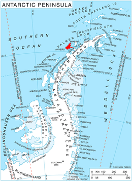
Location of Anvers Island in the Antarctic Peninsula region.
The Lajarte Islands (64°14′S 63°24′W / 64.233°S 63.400°WCoordinates: 64°14′S 63°24′W / 64.233°S 63.400°W) are a group of islands fringing the north coast of Anvers Island, close west of Cape Grönland and 1.5 km east-northeast of Lapteva Island, in the Palmer Archipelago, Antarctica.
The islands were discovered by a German expedition under Eduard Dallmann, 1873–74. They were charted by the French Antarctic Expedition, 1903–05, and named by Jean-Baptiste Charcot for Captain Dufaure de Lajarte of the French Navy.[1]
See also
References
- ↑ "Lajarte Islands". Geographic Names Information System. United States Geological Survey. Retrieved 2013-05-24.
![]() This article incorporates public domain material from the United States Geological Survey document "Lajarte Islands" (content from the Geographic Names Information System).
This article incorporates public domain material from the United States Geological Survey document "Lajarte Islands" (content from the Geographic Names Information System).
This article is issued from Wikipedia - version of the 11/21/2015. The text is available under the Creative Commons Attribution/Share Alike but additional terms may apply for the media files.