Kot Diji
| کوٹ ڈیجی (Urdu) | |
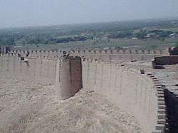
 View of the Kot Diji Fort from the town | |
 Shown within Pakistan | |
| Location | Khairpur District, Sindh, Pakistan |
|---|---|
| Coordinates | 27°20′44″N 68°42′24″E / 27.34556°N 68.70667°ECoordinates: 27°20′44″N 68°42′24″E / 27.34556°N 68.70667°E |
| Type | Settlement |
| History | |
| Periods | Harappan 1 to Harappan 2 |
| Cultures | Indus Valley Civilization |
| Site notes | |
| Excavation dates | 1955, 1957 |
The ancient site at Kot Diji (Urdu: کوٹ ڈیجی) was the forerunner of the Indus Civilization. The occupation of this site is attested already at 3300 BCE. The remains consist of two parts; the citadel area on high ground (about 12 m), and outer area. The Pakistan Department of Archaeology excavated at Kot Diji in 1955 and 1957.[1]
Located about 22 kilometers south of Khairpur in the province of Sindh, Pakistan. It is on the east bank of the Indus opposite Mohenjo-daro.
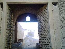
The site is situated at the foot of the Rohri Hills where a fort (Kot Diji Fort) was built around 1790 by Talpur dynasty ruler of Upper Sindh, Mir Suhrab who reigned from 1783 to 1830 AD. This fort built on the ridge of a steep narrow hill is well preserved.
Historical significance
Early Harappan towns (4000–3000 BCE)
The development of these farming communities in different parts of Baluchistan and Lower Sind, ultimately led to urbanization. The earliest fortified town to date is found at Rehman Dheri, dated 4000 BCE in Khyber Pakhtunkhwa close to River Zhob Valley. Other fortified towns found to date are at Amri (3600–3300 BCE) and Kot Diji in Sind and at Kalibangan (3000 BCE), India at the Hakra River.
Kot Diji culture (3300–2600 BCE)
The site covers 2.6 ha. The earliest occupation of this site is termed 'Kot Dijian', which is pre-Harappan, or early formative Harappan.[2]
At the earliest layer, Kot Diji I (2605 BC), copper and bronze were not used.[3]
The houses and fortifications were made from unbaked mud-bricks. Lithic material, such as leaf-shaped chert arrowheads, shows parallels with Mundigak layers II-IV. The pottery seems to anticipate Harappan Ware.[4]
Later, bronze was used, but only for personal ornaments. Also, potters wheel was already used.
The Early Harappan phase consists of two clearly defined areas.
Citadel on high ground for the elites separated by a defensive wall with bastions at regular intervals. This area measures about 500 ft x 350 ft.
Outer area, or the city proper consisted of houses of mud bricks on stone foundations. Pottery found from this site have design with horizontal and wavy lines, or loops and simple triangular patterns.
Other objects found are pots, pans, storage jars, toy carts, balls, bangles, beads, terracotta figurines of mother goddess and animals, bronze arrowheads. Well fashioned stone implements were also discovered.
The interesting find at Kot Diji is a toy cart, which shows that potter’s wheel lead to wheels for bullock carts.
Progress towards Harappa Phase
Glazed steatite beads were produced. There was a clear transition from the earlier Ravi pottery to what is commonly referred to as Kot Diji pottery. Red slip and black painted designs replaced polychrome decorations of the Ravi Phase. Then, there was a gradual transformation into what is commonly referred to as Harappa Phase pottery.[5]
Early Indus script may have appeared at Kot Diji on pottery and on a sealing. The use of inscribed seals and the standardization of weights may have occurred during the Kot Diji period.[6]
Late Kot-Diji type pots were found as far as Burzahom in Jammu and Kashmir.
Massive burning
There are obvious signs of massive burning of over the entire site, including both the lower habitation area and the high mound (the fortified town), which were also observed at other Early Harappan sites: Period III at Gumla, Period II at Amri, Period ID at Naushero. Signs of cleavage were observed at Early Harappan phase Period I at Kalibangan. The cause of the disruptions and/or abandonment of these sites toward the end of the Early Harappan phase is still unexplained.[7]
Rani Kot (600-1843 AD)


According to legends, the wall existed during Umayyad rule and later under the Abbasid rule. The Soomro tribe inhabited the fort and later the Samma tribe positioned large infantry formations inside the fort.
The Mughal Emirs armed the walls of the fort with cannons and muskets. They were the first to renovate the entire structure. The Kalhora tribe later gained control of the fort, and finally the Talpurs saw the fort as a strategic asset especially during the reign of Mir Fatih Ali Khan Talpur, until they were defeated and overthrown by the British Empire, in 1843 AD.
See also
- Sothi
- Indus Valley Civilization
- List of Indus Valley Civilization sites
- List of inventions and discoveries of the Indus Valley Civilization
- Hydraulic engineering of the Indus Valley Civilization
Notes
- ↑ Possehl, Gregory L. (2004). The Indus Civilization: A contemporary perspective, New Delhi: Vistaar Publications, ISBN 81-7829-291-2, pp.72-4.
- ↑ Sigfried J. de Laet, Ahmad Hasan Dani, eds. History of Humanity: From the third millennium to the seventh century B.C. UNESCO, 1996 ISBN 9231028111 p.674
- ↑ R.K. Pruthi, Indus Civilization. Discovery Publishing House, 2004 ISBN 8171418651 p22
- ↑ R.K. Pruthi, Indus Civilization. Discovery Publishing House, 2004 ISBN 8171418651 p22
- ↑ Ravi and Kot Diji Phase Developments harappa.com
- ↑ Ravi and Kot Diji Phase Developments harappa.com
- ↑ Possehl, Gregory L. (2004). The Indus Civilization: A contemporary perspective, New Delhi: Vistaar Publications, ISBN 81-7829-291-2, pp.47-50.
External links
- Ravi and Kot Diji Phase Developments harappa.com