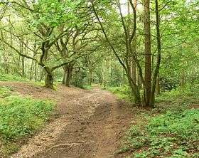
Kingsford Country Park
| Kingsford County Park | |
|---|---|
 | |
| Type | Country Park |
| Location | Kingsford, Worcestershire, England, U.K. |
| Coordinates | 52°26′22″N 2°15′00″W / 52.439575°N 2.24989°WCoordinates: 52°26′22″N 2°15′00″W / 52.439575°N 2.24989°W |
| Area | 200 acres (80.94 ha) |
| Operated by | Wyre Forest District Council |
Kingsford Country Park is located in Worcestershire, England, U.K.. It is next to Kinver Edge, Staffordshire, which can be accessed via multiple paths.
The country park covers 200 acres (0.81 km2), consisting mainly of pine and broadleaved woodland with some heathland and a small section of grassland. The woodland stretches over a terrain of hills and cliffs, with many sandy paths crisscrossing the lower woodland—some even going up cliff outcrops and across to a middle section between the woodland floor and clifftops—and the main paths leading up to the cliffs, which are also dominated by woodland.
There are also four circular trails starting from Kingsford Lane and Blakeshall Lane car parks, which have been designed to give an enjoyable woodland experience to a range of participants:
- The Robin Trail, a third of a mile (0.5 km)
- The Coal Tit Trail, over one mile (2 km)
- The Nuthatch Trail, about one and a half miles (2.5 km)
- The Woodpecker Trail, almost two miles (3 km)
References/External Links
- Enjoy England- Kingsford Forest Park.
- The AA - Kingsford Country Park and villages
- Kinver Edge
- Kingsford Forest Park