Kegelman Air Force Auxiliary Field
| Kegelman Air Force Auxiliary Field | |||||||||||
|---|---|---|---|---|---|---|---|---|---|---|---|
| IATA: CKA – ICAO: KCKA – FAA LID: CKA | |||||||||||
| Summary | |||||||||||
| Airport type | Military | ||||||||||
| Owner/Operator | 71st Flying Training Wing (71 FTW) | ||||||||||
| Location | Cherokee, Oklahoma, United States | ||||||||||
| Elevation AMSL | 366 m / 1,202 ft | ||||||||||
| Coordinates | 36°44′17″N 098°07′34″W / 36.73806°N 98.12611°WCoordinates: 36°44′17″N 098°07′34″W / 36.73806°N 98.12611°W | ||||||||||
| Map | |||||||||||
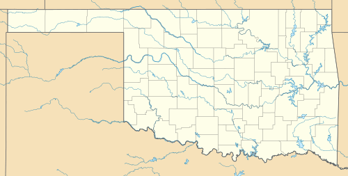
 CKA Location of the airport in Oklahoma | |||||||||||
| Runways | |||||||||||
| |||||||||||
Kegelman Air Force Auxiliary Field (IATA: CKA, ICAO: KCKA, FAA LID: CKA) is located near the Salt Plains National Wildlife Refuge in Alfalfa County, Oklahoma, across the Great Salt Plains Lake, 20 km (12 mi) east of Cherokee, Oklahoma in the United States.
The field has one runway, a fire station, personnel offices and a NEXRAD tower, which is used for weather forecasting for both the military and civilian entities.[1] It is located on 1,066 acres (4.31 km2).[2]
Currently, Kegelman AFAF is a sub-base of Vance Air Force Base under the control of the 71st Flying Training Wing (71 FTW). The airfield was previously administered by Will Rogers Field, Clovis Army Air Field, Woodward Army Air Field, and Liberal Army Airfield prior to the U.S. Air Force becoming an independent service in 1947.[3]
Vance AFB student pilots and instructor pilots use the airfield to practice landings in T-6A Texan II aircraft, and refer to the field with the callsign "Dogface".
The installation was first known as the Great Salt Plains Auxiliary Field, but was renamed Kegelman in 1949.[4]
References
See also: