Iardanos
| Iardanos Ιάρδανος | |
|---|---|
 Iardanos | |
|
Location within the regional unit 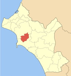 | |
| Coordinates: 37°44′N 21°24′E / 37.733°N 21.400°ECoordinates: 37°44′N 21°24′E / 37.733°N 21.400°E | |
| Country | Greece |
| Administrative region | West Greece |
| Regional unit | Elis |
| Municipality | Pyrgos |
| • Municipal unit | 62.723 km2 (24.217 sq mi) |
| Elevation | 6 m (20 ft) |
| Population (2011)[1] | |
| • Municipal unit | 3,673 |
| • Municipal unit density | 59/km2 (150/sq mi) |
| Time zone | EET (UTC+2) |
| • Summer (DST) | EEST (UTC+3) |
| Postal code | 271 00 |
| Area code(s) | 26210 |
| Vehicle registration | ΗΑ |
Iardanos (Greek: Ιάρδανος) is a former municipality in Elis, West Greece, Greece. Since the 2011 local government reform it is part of the municipality Pyrgos, of which it is a municipal unit.[2] The municipal unit has an area of 62.723 km2.[3] Its seat of administration was the village Vounargo. Iardanos is enclosed by the municipal units of Amaliada to the north, and Pyrgos to the south.
Subdivisions
The municipal unit Iardanos is subdivided into the following communities (constituent villages in brackets):
- Agioi Apostoloi
- Alpochori (Alpochori, Chanakia, Kapandriti)
- Fonaitika
- Katsaros
- Koryfi (Koryfi, Moni Fragkopidimatos)
- Prasino (Prasino, Glykorizo, Keramidia)
- Vounargo
- Vrochitsa
- Xylokera
Historical population
| Year | Population |
|---|---|
| 1991 | 4,103 |
| 2001 | 4,016 |
| 2011 | 3,673 |
References
- ↑ "Απογραφή Πληθυσμού - Κατοικιών 2011. ΜΟΝΙΜΟΣ Πληθυσμός" (in Greek). Hellenic Statistical Authority.
- ↑ Kallikratis law Greece Ministry of Interior (Greek)
- ↑ "Population & housing census 2001 (incl. area and average elevation)" (PDF) (in Greek). National Statistical Service of Greece.
See also
 |
Amaliada | Amaliada | | |
| |
Pyrgos | |||
| ||||
| | ||||
| Pyrgos | Pyrgos |
This article is issued from Wikipedia - version of the 11/15/2016. The text is available under the Creative Commons Attribution/Share Alike but additional terms may apply for the media files.