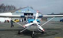
Havlíčkův Brod Airport
| Havlíčkův Brod Airport Letiště Havlíčkův Brod | |||||||||||
|---|---|---|---|---|---|---|---|---|---|---|---|
 | |||||||||||
| IATA: none – ICAO: LKHB | |||||||||||
| Summary | |||||||||||
| Airport type | Public, no Pudlic International airport | ||||||||||
| Operator | Aeroport Havlickuv Brod | ||||||||||
| Serves | Havlíčkův Brod | ||||||||||
| Location | 0.5 kilometres (0.31 mi) SW from Havlickuv Brod | ||||||||||
| Elevation AMSL | 1,519 ft / 465 m | ||||||||||
| Coordinates | 49°35′50″N 015°32′57″E / 49.59722°N 15.54917°ECoordinates: 49°35′50″N 015°32′57″E / 49.59722°N 15.54917°E | ||||||||||
| Website | www.aeroklubhb.cz | ||||||||||
| Runways | |||||||||||
| |||||||||||
Havlíčkův Brod Airport (Czech: Letiště Havlíčkův Brod) (ICAO: LKHB[1][2]) is a public aerodrome and no public international airport with civil traffic. It is situated approximately 1.8 kilometres (1 mi) southwest of Havlíčkův Brod, a town in the Vysočina Region of the Czech Republic, at the border of Czech highlands. The airport is plentifully used for sport flying and sightseeing flights above the Czech highlands.
References
- ↑ Airport information for LKHB at Great Circle Mapper.
- ↑ Accident history for LKHB at Aviation Safety Network
External links
This article is issued from Wikipedia - version of the 8/20/2013. The text is available under the Creative Commons Attribution/Share Alike but additional terms may apply for the media files.