Goicoechea (canton)
Coordinates: 9°56′32″N 84°03′11″W / 9.94229°N 84.0531°W

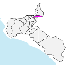
Goicoechea canton in San José province
Goicoechea is the eighth canton in the province of San José in Costa Rica. The canton covers an area of 31.5 km2 (12.2 sq mi),[1] and has a population of 124,704.[2] The capital city of the canton is Guadalupe.
The elongated canton snakes its way through the suburban areas just north of San José Centro, climbing steadily into the Cordillera Central (Central Mountain Range) until it reaches it eastern limit between the Río Durazno (on its northern boundary) and the Río Tiribí (on the south).
Districts
The canton of Goicoechea is subdivided into these seven districts (Spanish: distritos):[3]
- Guadalupe
- San Francisco
- Calle Blancos
- Mata de Plátano
- Ipís
- Rancho Redondo
- Purral
History
The canton was established by a legislative decree of August 6, 1891.
References
- ↑ Instituto Geográfico Nacional (IGN), 2001.
- ↑ Estimates of Instituto Nacional de Estadística y Censos (INEC), May 2003.
- ↑ "División Territorial Administrativa de Costa Rica" (PDF) (in Spanish). Instituto de Fomento y Asesoria Municipal (IFAM). 5 May 2009.
This article is issued from Wikipedia - version of the 8/19/2016. The text is available under the Creative Commons Attribution/Share Alike but additional terms may apply for the media files.