Gehrihorn
| Gehrihorn | |
|---|---|
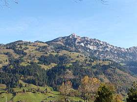 Gehrihorn viewed from the village of Frutigen | |
| Highest point | |
| Elevation | 2,130 m (6,990 ft) |
| Prominence | 40 m (130 ft) [1] |
| Parent peak | Rüederigsgrat (2,142 m) |
| Coordinates | 46°34′25.7″N 7°41′32″E / 46.573806°N 7.69222°ECoordinates: 46°34′25.7″N 7°41′32″E / 46.573806°N 7.69222°E |
| Geography | |
 Gehrihorn Location in Switzerland | |
| Location | Bern, Switzerland |
| Parent range | Bernese Alps |
The Gehrihorn is a mountain of the Bernese Alps, overlooking Frutigen in the Bernese Oberland. It lies at the northern end of the range between the Kandertal and the Kiental.
References
- ↑ Retrieved from the Swisstopo topographic maps and Google Earth. The key col is located south of the summit at 2,090 metres.
External links
This article is issued from Wikipedia - version of the 5/9/2016. The text is available under the Creative Commons Attribution/Share Alike but additional terms may apply for the media files.