Ganikapudi
| Ganikapudi గనికపూడి | |
|---|---|
| Village | |
|
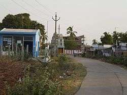
Entrance of Ganikapudi village | |
 Ganikapudi  Ganikapudi Location in Andhra Pradesh, India | |
| Coordinates: 16°09′07″N 80°16′52″E / 16.15194°N 80.28111°ECoordinates: 16°09′07″N 80°16′52″E / 16.15194°N 80.28111°E | |
| Country | India |
| State | Andhra Pradesh |
| District | Guntur |
| Government | |
| • Type | Gram Panchayat |
| Area[1] | |
| • Total | 5.30 km2 (2.05 sq mi) |
| Elevation[2] | 26 m (85 ft) |
| Population (2011)[1] | |
| • Total | 1,929 |
| • Density | 360/km2 (940/sq mi) |
| Languages | |
| • Official | Telugu |
| Time zone | IST (UTC+5:30) |
| PIN | 522019 |
| Telephone code | 91-863 |
| Vehicle registration | AP 07, AP 08 |
Ganikapudi /ɡənikəpudi/ is a village in Guntur district of the Indian state of Andhra Pradesh. It is located in Prathipadu mandal of Guntur revenue division.[3][4] It is one of the villages in the mandal to be a part of Andhra Pradesh Capital Region.[5]
Geography
Ganikapudi is located at an average altitude of 26 m (85 ft)
Transport
State run APSRTC provides bus services to various places from Ganikapudi. The village is connected to the mandal headquarters, Prathipadu by Ganikapudi road.[6]
Politics
Ganikapudi is a part of Prathipadu assembly constituency for Andhra Pradesh Legislative Assembly. Ravela Kishore Babu is the present MLA of the constituency from Telugu Desam Party.[7] It is inturn a part of Guntur (Lok Sabha constituency).[8]
Education
MPPS (Urdu) and MPUPS are the schools in the village.[9]
References
- 1 2 "District Census Handbook - Guntur" (PDF). Census of India. p. 14,426. Retrieved 22 September 2015.
- ↑ "Elevation for Ganikapudi". Veloroutes. Retrieved 14 November 2015.
- ↑ "District Level Mandal wise List of Villages in Andhra Pradesh" (PDF). Chief Commissioner of Land Administration. National Informatics Centre. p. 9. Archived from the original (PDF) on 10 December 2014. Retrieved 19 September 2015.
- ↑ "Adminsistrative divisions of Guntur district" (PDF). guntur.nic.in. Retrieved 26 May 2014.
- ↑ "AP Capital Region mandals and villages" (PDF). Andhra Pradesh Capital Region Development Authority. Government of Andhra Pradesh. Retrieved 23 September 2015.
- ↑ "Map of Ganikapudi, Prathipadu, Guntur, Andhra Pradesh". mapsofindia.com.
- ↑ "MLA". AP State Portal. Retrieved 13 October 2014.
- ↑ "Delimitation of Parliamentary and Assembly Constituencies Order, 008" (PDF). Election Commission of India. p. 22,31. Retrieved 11 October 2014.
- ↑ "School Information". Commissionerate of School Education. Government of Andhra Pradesh. Retrieved 14 November 2015.
External links
| Wikimedia Commons has media related to Ganikapudi. |
