Frigga Peak
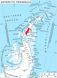
Location of Foyn Coast on Antarctic Peninsula.
Frigga Peak (66°25′S 64°0′W / 66.417°S 64.000°WCoordinates: 66°25′S 64°0′W / 66.417°S 64.000°W) is a peak, 1,570 metres (5,150 ft) high, which stands at the south side of Anderson Glacier on the east coast of Graham Land, Antarctica. It was charted by the Falkland Islands Dependencies Survey (FIDS) and photographed from the air by the Ronne Antarctic Research Expedition in 1947. The FIDS named it after the Norse goddess Frigga, the "cloud spinner," because clouds were observed to form on the summit of this peak earlier than on any other feature in this vicinity.[1]
References
- ↑ "Frigga Peak". Geographic Names Information System. United States Geological Survey. Retrieved 2012-04-10.
![]() This article incorporates public domain material from the United States Geological Survey document "Frigga Peak" (content from the Geographic Names Information System).
This article incorporates public domain material from the United States Geological Survey document "Frigga Peak" (content from the Geographic Names Information System).
This article is issued from Wikipedia - version of the 11/21/2015. The text is available under the Creative Commons Attribution/Share Alike but additional terms may apply for the media files.