Foley Glacier
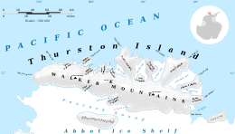
Map of Thurston Island.

Satellite image of Thurston Island.
Foley Glacier (71°58′S 101°10′W / 71.967°S 101.167°WCoordinates: 71°58′S 101°10′W / 71.967°S 101.167°W) is a glacier about 4 nautical miles (7 km) long flowing north from the western end of Thurston Island just east of Cape Petersen. It was named by the Advisory Committee on Antarctic Names after Kevin M. Foley, of the United States Geological Survey, Reston, Virginia, a computer specialist and team member of the Glaciological and Coastal-Change Maps of Antarctica Project.[1]
Maps
- Thurston Island – Jones Mountains. 1:500000 Antarctica Sketch Map. US Geological Survey, 1967.
- Antarctic Digital Database (ADD). Scale 1:250000 topographic map of Antarctica. Scientific Committee on Antarctic Research (SCAR). Since 1993, regularly upgraded and updated.
References
- ↑ "Foley Glacier". Geographic Names Information System. United States Geological Survey. Retrieved 2012-03-29.
![]() This article incorporates public domain material from the United States Geological Survey document "Foley Glacier" (content from the Geographic Names Information System).
This article incorporates public domain material from the United States Geological Survey document "Foley Glacier" (content from the Geographic Names Information System).
This article is issued from Wikipedia - version of the 1/31/2016. The text is available under the Creative Commons Attribution/Share Alike but additional terms may apply for the media files.