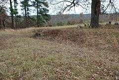
Dooley's Ferry Fortifications Historic District
|
Dooley's Ferry Fortifications Historic District | |
|
Cemetery with earthworks | |
  | |
| Nearest city | Spring Hill |
|---|---|
| Coordinates | 33°30′34.097″N 93°43′03.902″W / 33.50947139°N 93.71775056°W |
| Area | 24 acres (9.7 ha) |
| NRHP Reference # | 04001031[1] |
| Added to NRHP | September 22, 2004 |
The Dooley's Ferry Fortifications Historic District encompasses a series of military earthworks erected in southwestern Arkansas, along the Red River in Hempstead County. They were constructed in late 1864 by Confederate Army troops under orders from General John B. Magruder as a defense against the potential movements of Union Army forces toward Shreveport, Louisiana. They command a formerly major road intersection just east of Dooley's Ferry, one of the most important regional crossings of the Red River. After the war a cemetery for African-Americans (known as the Dooley Hill Cemetery[2]) was established adjacent to one of the gun emplacements.[3]
The fortifications were listed on the National Register of Historic Places in 2004.[1]
External links
- Encyclopedia of Arkansas History & Culture
- Environs of Dooley's Ferry M. A. Miller, Assistant Engineer, May 1864
Gallery
-

Thomas Dooley 1837 Land Patent.
-

Thomas Dooley 1839 Land Patent.
-

Map circa 1861-1865.
-

Survey map 1900.
See also
References
- 1 2 National Park Service (2010-07-09). "National Register Information System". National Register of Historic Places. National Park Service.
- ↑ "Dooley Hill Cemetery (33.507375,-93.700960)". Find A Grave. Retrieved 25 July 2016.
- ↑ "Summary description for Dooley's Ferry Fortifications Historic District". Arkansas Preservation. Retrieved 2014-09-16.
