Czerep
| Czerep | |
|---|---|
| Todtenkopf | |
|
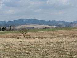
Czerep seen from Lipienica | |
| Highest point | |
| Elevation | 581 m (1,906 ft) |
| Coordinates | 50°42′20″N 16°07′56″E / 50.70556°N 16.13222°ECoordinates: 50°42′20″N 16°07′56″E / 50.70556°N 16.13222°E |
| Geography | |
 Czerep | |
| Parent range | Krzeszowskie Wzgórza |
Czerep [tʂɛrɛp] (ger. Todten Kopf, Todtenkopf, 581 m a.s.l.) – hill in the southern part of the band Krzeszowskie Wzgórza, within Kotlina Kamiennogórska, in Central Sudetes.
Position
The peak is located in the southern part of the Krzeszowskie Wzgórza; It is the southern tip. In the north, through Przełęcz Żłób connects to the Post Berg. Southern slopes steeply fall into the stream Kochanówka that separates Krzeszowskie Wzgórza of Zawory Mountains.
The geologic structure
Masyw zbudowany jest z Credaceus sandstones glauconite and mudstones.
Vegetation
The apex as well as the majority of bands covered with pine forest, down, east and west extend meadows.
Bibliography
- Słownik geografii turystycznej Sudetów, tom 8 Kotlina Kamiennogórska, Wzgórza Bramy Lubawskiej, Zawory, red. Marek Staffa, Wydawnictwo I-BiS, Wrocław 1997, ISBN 83-85773-23-1, s. 89 i 90
- Sudety Środkowe. Skala 1:40000. Jelenia Góra: Wydawnictwo Turystyczne Plan, 2005. ISBN 83-60044-44-9.
This article is issued from Wikipedia - version of the 6/17/2016. The text is available under the Creative Commons Attribution/Share Alike but additional terms may apply for the media files.