Cima Rossa
| Cima Rossa | |
|---|---|
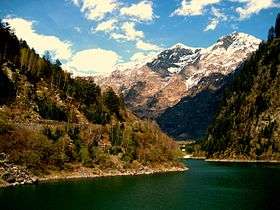 Cima Rossa (centre-right) from Lago di Malvaglia | |
| Highest point | |
| Elevation | 3,161 m (10,371 ft) |
| Prominence | 236 m (774 ft) [1] |
| Parent peak | Vogelberg |
| Coordinates | 46°26′37.5″N 9°5′13.4″E / 46.443750°N 9.087056°ECoordinates: 46°26′37.5″N 9°5′13.4″E / 46.443750°N 9.087056°E |
| Geography | |
 Cima Rossa Location in Switzerland | |
| Location | Graubünden/Ticino, Switzerland |
| Parent range | Lepontine Alps |
Cima Rossa is a 3,161 metres high mountain in the Lepontine Alps, located on the border between the cantons of Ticino and Graubünden. On the west side it overlooks the valley of Malvaglia (Ticino) and on the east side it overlooks the valley of Calanca (Graubünden).
Cima Rossa is connected to the higher massif of the Vogelberg by a four km ridge, not descending lower than 2,925 metres. A secondary summit (3,121 metres) named Piz Piotta lies north of the summit of Cima Rossa. A small glacier lies between them on the west flanks, named Ghiacciaio di Piotta.
References
External links
This article is issued from Wikipedia - version of the 5/8/2016. The text is available under the Creative Commons Attribution/Share Alike but additional terms may apply for the media files.