Ch'aki Qucha
This article is about the mountain in the Potosí Department, Bolivia. For other uses, see Ch'aki Qucha (disambiguation).
| Ch'aki Qucha | |
|---|---|
 Ch'aki Qucha Location in Bolivia | |
| Highest point | |
| Elevation | 4,628 m (15,184 ft) [1] |
| Coordinates | 19°44′08″S 65°35′30″W / 19.73556°S 65.59167°WCoordinates: 19°44′08″S 65°35′30″W / 19.73556°S 65.59167°W |
| Geography | |
| Location |
Bolivia, Potosí Department, José María Linares Province |
| Parent range | Andes, Potosí mountain range |
Ch'aki Qucha (Quechua ch'aki dry, qucha lake,[2] "dry lake", also spelled Chaqui Khocha) is a 4,628-metre-high (15,184 ft) mountain in the Potosí mountain range in the Bolivian Andes at a lake of the same name. It is located in the Potosí Department, José María Linares Province, in the west of the Puna Municipality. Ch'aki Qucha lies south of the mountain Kuntur Ikiña, northeast of Kunturiri and a lake named T'ala Qucha and southeast of Jatun Kunturiri.[1][3][4]
The lake named Ch'aki Qucha is northwest of the mountain at 19°43′52″S 65°36′20″W / 19.73111°S 65.60556°W.[1]
References
- 1 2 3 Bolivian IGM map 1:50,000 Puna 6434-I
- ↑ Teofilo Laime Ajacopa, Diccionario Bilingüe Iskay simipi yuyayk'ancha, La Paz, 2007 (Quechua-Spanish dictionary)
- ↑ "South America Maps" (PDF). Joint Operations Graphic. Retrieved October 6, 2014.
- ↑ "Puna". INE, Bolivia. Retrieved October 6, 2014. (unnamed)
Capital: Potosí | ||
| Provinces | 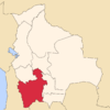 | |
| Municipalities (and seats) |
| |
This article is issued from Wikipedia - version of the 5/2/2016. The text is available under the Creative Commons Attribution/Share Alike but additional terms may apply for the media files.