Broadland (UK Parliament constituency)
| Broadland | |
|---|---|
|
County constituency for the House of Commons | |
|
Boundary of Broadland in Norfolk. | |
|
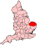
Location of Norfolk within England. | |
| County | Norfolk |
| Population | 95,188 (2011 census)[1] |
| Electorate | 73,066 (December 2010)[2] |
| Current constituency | |
| Created | 2010 |
| Member of parliament | Keith Simpson (Conservative) |
| Number of members | One |
| Created from | Mid Norfolk, North Norfolk |
| Overlaps | |
| European Parliament constituency | East of England |
Broadland is a constituency[n 1] represented in the House of Commons of the UK Parliament since its 2010 creation by Keith Simpson of the Conservative Party.[n 2]
History
The Boundary Commission for England created the Broadland constituency as the successor seat to Mid Norfolk by adding parts of North Norfolk and Norwich North. The name is taken from the local government area Broadland though its boundary does not match that of the district council nor is it coterminous with the Norfolk Broads (waterways) and surrounding protected land.
Boundaries
The District of Broadland wards of Acle, Aylsham, Blofield with South Walsham, Brundall, Burlingham, Buxton, Coltishall, Drayton North, Drayton South, Eynesford, Great Witchingham, Hevingham, Horsford and Felthorpe, Marshes, Plumstead, Reepham, Spixworth with St Faiths, Taverham North, Taverham South, and Wroxham, and the District of North Norfolk wards of Astley, Lancaster North, Lancaster South, The Raynhams, Walsingham, and Wensum.
The new Broadland seat takes its name from the local government district, from which 20 electoral wards are taken. Six wards from North Norfolk district are also used in the creation of this seat.
The constituency stretches from near Yarmouth in the east to the north west of the county. Among attractions within the seat's boundaries are the steam and fairground collection at Thursford and the Anglican shrine at Walsingham; both were in the Norfolk North constituency until 2010.
Members of Parliament
| Election | Member[3] | Party | |
|---|---|---|---|
| 2010 | Keith Simpson | Conservative | |
Elections
Elections in the 2010s
| Party | Candidate | Votes | % | ± | |
|---|---|---|---|---|---|
| Conservative | Keith Simpson | 26,808 | 50.5 | +4.3 | |
| Labour | Chris Jones [5] | 9,970 | 18.8 | +4.9 | |
| UKIP | Stuart Agnew [5] | 8,881 | 16.7 | +12.2 | |
| Liberal Democrat | Steve Riley | 5,178 | 9.8 | −22.6 | |
| Green | Andrew Boswell | 2,252 | 4.2 | +2.8 | |
| Majority | 16,838 | 31.7 | +17.9 | ||
| Turnout | 53,098 | 71.1 | −0.9 | ||
| Conservative hold | Swing | ||||
| Party | Candidate | Votes | % | ± | |
|---|---|---|---|---|---|
| Conservative | Keith Simpson* | 24,338 | 46.2 | +2.8 | |
| Liberal Democrat | Daniel Roper | 17,046 | 32.4 | +2.9 | |
| Labour | Allyson Barron | 7,287 | 13.8 | −9.8 | |
| UKIP | Stuart Agnew | 2,382 | 4.5 | +1.1 | |
| BNP | Edith Crowther | 871 | 1.7 | +1.7 | |
| Green | Susan Curran | 752 | 1.4 | +1.4 | |
| Majority | 7,292 | 13.8 | |||
| Turnout | 52,676 | 72.0 | +7.6 | ||
| Conservative win (new seat) | |||||
- * Served in the 2005–2010 Parliament as MP for Mid Norfolk
See also
Notes and references
- Notes
- ↑ A county constituency (for the purposes of election expenses and type of returning officer)
- ↑ As with all constituencies, the constituency elects one Member of Parliament (MP) by the first past the post system of election at least every five years.
- References
- ↑ "Broadland: Usual Resident Population, 2011". Neighbourhood Statistics. Office for National Statistics. Retrieved 4 February 2015.
- ↑ "Electorate Figures - Boundary Commission for England". 2011 Electorate Figures. Boundary Commission for England. 4 March 2011. Archived from the original on 6 November 2010. Retrieved 13 March 2011.
- ↑ Leigh Rayment's Historical List of MPs – Constituencies beginning with "B" (part 6)
- ↑ "Election Data 2015". Electoral Calculus. Archived from the original on 17 October 2015. Retrieved 17 October 2015.
- 1 2 http://electionresults.blogspot.co.uk/2013/04/broadland-2015.html
- ↑ "Election Data 2010". Electoral Calculus. Archived from the original on 17 October 2015. Retrieved 17 October 2015.
- ↑ 2010 election result, BBC News, 7 May 2010
External links
- nomis Constituency Profile for Broadland — presenting data from the ONS annual population survey and other official statistics.
Coordinates: 52°43′N 1°10′E / 52.72°N 1.16°E

