Betty's Bay
| Betty's Bay Bettysbaai | |
|---|---|
|
Betty's Bay | |
 Betty's Bay  Betty's Bay  Betty's Bay
| |
| Coordinates: 34°22′S 18°54′E / 34.36°S 18.90°ECoordinates: 34°22′S 18°54′E / 34.36°S 18.90°E | |
| Country | South Africa |
| Province | Western Cape |
| District | Overberg |
| Municipality | Overstrand |
| Established | 1930 |
| Area[1] | |
| • Total | 20.99 km2 (8.10 sq mi) |
| Population (2011)[1] | |
| • Total | 1,380 |
| • Density | 66/km2 (170/sq mi) |
| Racial makeup (2011)[1] | |
| • Black African | 3.7% |
| • Coloured | 21.1% |
| • Indian/Asian | 0.3% |
| • White | 72.6% |
| • Other | 2.3% |
| First languages (2011)[1] | |
| • Afrikaans | 60.5% |
| • English | 36.5% |
| • Other | 3.0% |
| PO box | 7141 |
| Area code | 028 |

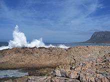
Betty's Bay (Afrikaans: Bettysbaai) is a small holiday town situated on the Overberg coast of South Africa's Western Cape province. It is located 96 km from Cape Town[2] beneath the rugged Kogelberg Mountains and is on the scenic R44 ocean drive between Pringle Bay and Kleinmond. This village stretches over 13 km along the Coast. Tourism plays a large role in the town's economy due to its popularity with holiday makers from across the Western Cape and Cape Town in particular.
During Colonial times Betty's Bay was allegedly a favourite place for runaway slaves, and in 1912 Betty's Bay became a formal whaling station running up until the 1930s. Remains of the whaling station can still be seen at Stony Point.
Bettys Bay is named after Betty Youlden, daughter of the first developer of the area Arthur Youlden.[3]
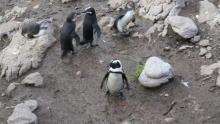
Betty's Bay contains the well known Harold Porter National Botanical Garden as well as an African penguin colony.

Notes
- 1 2 3 4 "Main Place Betty's Bay". Census 2011.
- ↑ "Betty's Bay". Retrieved 2008-06-10.
- ↑ http://overbergliving.weebly.com/bettys-bay.html, retrieved on 30 December 2015.
References
- Ocean Blue Local Information Source, Maps, Links and Property
- History of Betty's Bay
| Wikimedia Commons has media related to Betty's Bay. |

.svg.png)