Bakel, Senegal
| Bakel, Senegal | |
|---|---|
| Town | |
 Bakel | |
| Coordinates: 14°54′15″N 12°27′30″W / 14.90417°N 12.45833°WCoordinates: 14°54′15″N 12°27′30″W / 14.90417°N 12.45833°W | |
| Country |
|
| Region | Tambacounda |
| Department | Bakel |
| Population | |
| • Total | ~15,000 |
| Time zone | GMT (UTC+0) |
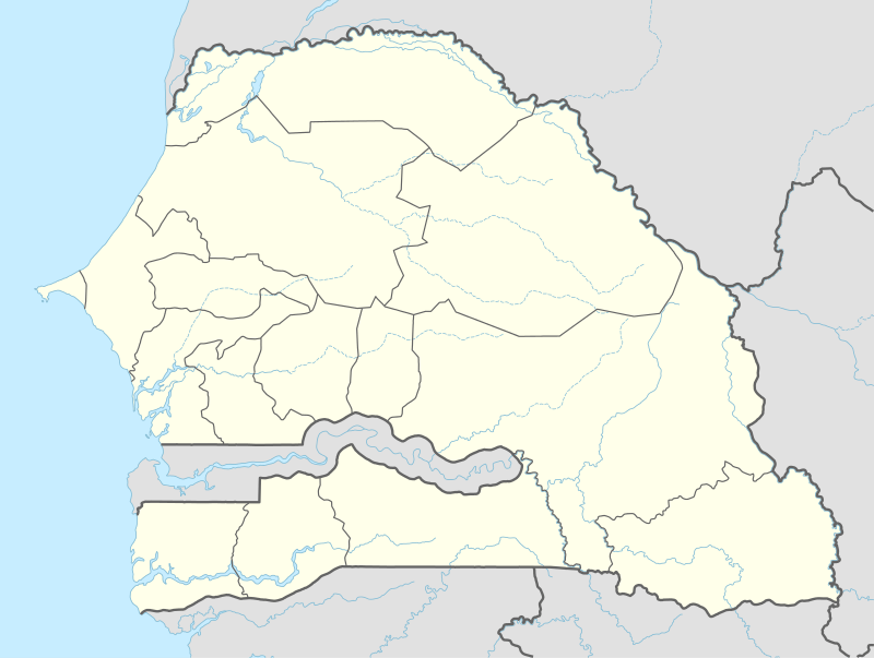
Bakel is a town of approximately 15,000 inhabitants located in the eastern part of Senegal, West Africa. The town is located on the left bank of the Sénégal River, 65 kilometers (40 mi) from the Malian border and linked by canoe ferry to the village of Gouraye in Mauritania.
Bakel is one of the four eponymous departmental capitals in the region of Tambacounda, the other three being Tambacounda, Goudiry and Koumpentoum. Bakel is known for its French fort (Fort Bakel), which René Caillié visited in 1819.[1] It was also the area where the Mauritanian crisis occurred, a dispute over grazing rights that led to a war between Senegal and Mauritania in 1989. As a result of this conflict, many people around the area moved abroad or emigrated to Senegal.
The majority of the population belong to the Soninke-speaking ethnic group, a dialect of the larger Mandagne-Mandinke language family. There is also a substantial Pulaar (Fula) speaking minority as well as a significant amount of Bambara and Wolof (or Oulof) speakers. While most people learn and speak French in school, they prefer to use local dialects in everyday conversation. A large permanent market serves the department's inhabitants along with a weekly "Lumo" (similar to a flea market). Most inhabitants are subsistence farmers and herders, while the people in town are employed in informal businesses that range from carpentry, masonry and transportation of goods to selling fruit and produce on the street. Due to its location in the Sahel, the area is semi-arid with little vegetation outside of the rainy season. Various hills surround the town, which are known locally as "little mountains."
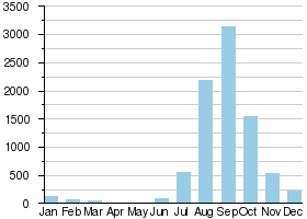
Bakel is also the site of a study of annual flow volumes of the Senegal river from 1904 to 1990 which showed a dramatic reduction in the river's volume especially in the past twenty years.[3]
Bakel City Gang is the name of a famous song made by Booba, a French rap star whose father originated from this town.
References
- ↑ Caillié, René (1830), Travels through Central Africa to Timbuctoo; and across the Great Desert, to Morocco, performed in the years 1824-1828 (Vol 1), London: Colburn & Bentley, p. 18.
- ↑ Hydrographic data for Bakel, Sénégal 1904-1984, Unesco International Hydrological Programme, retrieved 19 May 2012.
- ↑ "A water resources planning response to climate change in the Senegal River Basin". Venema, Schiller, Adamowska, Thizzy. January 1997
External links
| Wikimedia Commons has media related to Bakel (Senegal). |
