Arrondissement of Forbach-Boulay-Moselle
| Forbach-Boulay-Moselle | |
|---|---|
| Arrondissement of France | |
| Country | France |
| Region | Grand Est |
| Department | Moselle |
| Communes | 169 |
| Subprefecture | Forbach |
| Area¹ | |
| • Total | 1,283 km2 (495 sq mi) |
| Population (2013) | |
| • Total | 246,629 |
| • Density | 190/km2 (500/sq mi) |
| ¹ French Land Register data, which exclude lakes, ponds, and glaciers larger than 1 km² as well as the estuaries of rivers. | |
| Part of the series on |
| Lorraine |
|---|
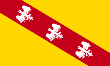
 Flag of Lorraine since the 13th century |
|
|
Administrative divisions
|
|
Lorraine in the EU |
|
Related topics |
|
The arrondissement of Forbach-Boulay-Moselle is an arrondissement of France in the Moselle department in the Grand Est region. It was created at the 2015 arrondissements reform by the merger of the former arrondissements of Forbach and Boulay-Moselle. It has 169 communes.[1]
Composition
Cantons
The cantons of the arrondissement of Forbach-Boulay-Moselle are:
- Boulay-Moselle
- Bouzonville (partly)
- Faulquemont (partly)
- Forbach
- Freyming-Merlebach
- Saint-Avold
- Sarralbe (partly)
- Stiring-Wendel
Communes
The communes of the arrondissement of Forbach-Boulay-Moselle are:[1]
- Adaincourt
- Adelange
- Alsting
- Altrippe
- Altviller
- Alzing
- Anzeling
- Arraincourt
- Arriance
- Bambiderstroff
- Bannay
- Baronville
- Barst
- Behren-lès-Forbach
- Béning-lès-Saint-Avold
- Bérig-Vintrange
- Berviller-en-Moselle
- Bettange
- Betting
- Bibiche
- Biding
- Bionville-sur-Nied
- Bisten-en-Lorraine
- Bistroff
- Boucheporn
- Boulay-Moselle
- Bousbach
- Boustroff
- Bouzonville
- Brettnach
- Brouck
- Brulange
- Cappel
- Carling
- Château-Rouge
- Chémery-les-Deux
- Cocheren
- Colmen
- Condé-Northen
- Coume
- Créhange
- Creutzwald
- Dalem
- Dalstein
- Denting
- Destry
- Diebling
- Diesen
- Diffembach-lès-Hellimer
- Ébersviller
- Éblange
- Eincheville
- Elvange
- Erstroff
- Etzling
- Falck
- Farébersviller
- Farschviller
- Faulquemont
- Filstroff
- Flétrange
- Folkling
- Folschviller
- Forbach
- Fouligny
- Freistroff
- Frémestroff
- Freybouse
- Freyming-Merlebach
- Gomelange
- Gréning
- Grostenquin
- Guenviller
- Guerstling
- Guerting
- Guessling-Hémering
- Guinglange
- Guinkirchen
- Hallering
- Ham-sous-Varsberg
- Han-sur-Nied
- Hargarten-aux-Mines
- Harprich
- Haute-Vigneulles
- Heining-lès-Bouzonville
- Hellimer
- Helstroff
- Hémilly
- Henriville
- Herny
- Hestroff
- Hinckange
- Holacourt
- Holling
- Hombourg-Haut
- L'Hôpital
- Hoste
- Kerbach
- Lachambre
- Landroff
- Laning
- Laudrefang
- Lelling
- Leyviller
- Lixing-lès-Saint-Avold
- Longeville-lès-Saint-Avold
- Macheren
- Mainvillers
- Many
- Marange-Zondrange
- Maxstadt
- Mégange
- Menskirch
- Merten
- Metzing
- Momerstroff
- Morhange
- Morsbach
- Narbéfontaine
- Neunkirchen-lès-Bouzonville
- Niedervisse
- Nousseviller-Saint-Nabor
- Oberdorff
- Obervisse
- Œting
- Ottonville
- Petite-Rosselle
- Petit-Tenquin
- Piblange
- Pontpierre
- Porcelette
- Racrange
- Rémelfang
- Rémering
- Rosbruck
- Roupeldange
- Saint-Avold
- Saint-François-Lacroix
- Schœneck
- Schwerdorff
- Seingbouse
- Spicheren
- Stiring-Wendel
- Suisse
- Tenteling
- Téterchen
- Teting-sur-Nied
- Théding
- Thicourt
- Thonville
- Tritteling-Redlach
- Tromborn
- Vahl-Ebersing
- Vahl-lès-Faulquemont
- Vallerange
- Valmont
- Valmunster
- Varize
- Varsberg
- Vatimont
- Vaudreching
- Velving
- Viller
- Villing
- Vittoncourt
- Vœlfling-lès-Bouzonville
- Voimhaut
- Volmerange-lès-Boulay
- Zimming
References
Coordinates: 49°06′N 6°42′E / 49.1°N 6.7°E
This article is issued from Wikipedia - version of the 11/18/2016. The text is available under the Creative Commons Attribution/Share Alike but additional terms may apply for the media files.