Arcella (Padua)
| Arcella | |
|---|---|
|
View of the district with St. Antonino church | |
| Coordinates: 45°25′21″N 11°53′8″E / 45.42250°N 11.88556°E | |
| Elevation | 12 m (39 ft) |
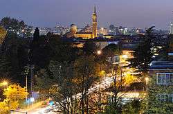
Arcella is the name of a district in Padua, located close to the Milan-Venice railway, north-east of the station. However, the urban expansion occurred since the 1950s made the bounds between the localities nearby imperceptible. People usually use the name "Arcella" to refer to the whole urban area north of the station.
This article is issued from Wikipedia - version of the 9/20/2013. The text is available under the Creative Commons Attribution/Share Alike but additional terms may apply for the media files.