Antambohobe
| Antambohobe | |
|---|---|
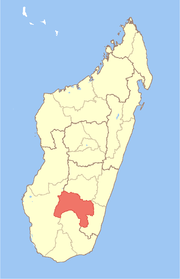
 Antambohobe Location in Madagascar | |
| Coordinates: 22°18′S 46°46′E / 22.300°S 46.767°E | |
| Country |
|
| Region | Ihorombe |
| District | Ivohibe |
| Elevation[1] | 755 m (2,475 ft) |
| Population (2001)[2] | |
| • Total | 9,000 |
| Time zone | EAT (UTC+3) |
Antambohobe is a town and commune in Madagascar. It belongs to the district of Ivohibe, which is a part of Ihorombe Region. The population of the commune was estimated to be approximately 9,000 in the 2001 commune census.[2]
Only primary schooling is available. Most of the inhabitants (75%) receive their support from agriculture; 24.4% of the inhabitants receive their support from raising livestock. Fishing supports 0.4% of the population; services provide employment for the remainder (0.2%). The most important crop is rice; other significant products are sugarcane, beans, maize and cassava.[2]
References and notes
- ↑ Estimated based on DEM data from Shuttle Radar Topography Mission
- 1 2 3 "ILO census data". Cornell University. 2002. Retrieved 1 May 2008.
Coordinates: 22°18′S 46°46′E / 22.300°S 46.767°E
This article is issued from Wikipedia - version of the 4/22/2015. The text is available under the Creative Commons Attribution/Share Alike but additional terms may apply for the media files.