A56 road
| |
|---|---|
 | |
| Route information | |
| Length: | 71.46 mi (115.00 km) |
| Major junctions | |
| West end: | Chester |
|
[[Image:Motorway Left.svg|[ |x30px|link=]] [[Image:Motorway Left.svg|[ |x30px|link=]] [[Image:Motorway Left.svg|[ |x22px|link=]] [[Image:Motorway Left.svg|[ |x30px|link=]] [[Image:Motorway Left.svg|[ |x30px|link=]] [[Image:Motorway Left.svg|[ |x30px|link=]] | |
| East end: | Broughton |
| Location | |
| Primary destinations: |
Runcorn Warrington Altrincham Manchester Bury Burnley |
| Road network | |
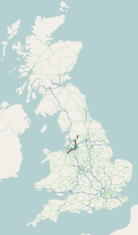
The A56 is a road in England which extends between the city of Chester in Cheshire and the village of Broughton in North Yorkshire. The road contains a mixture of single and dual carriageway sections, and traverses environments as diverse as the dense urban sprawl of inner city Manchester and the lightly populated region of rural east Lancashire. The road includes a short section of trunk road between the end of the M66 motorway near Ramsbottom and the M65 motorway west of Burnley.
Route description
The road begins as Frodsham Street in the centre of Chester at its junction with Eastgate Street A51 and heads north-eastwards out of the city. Just outside the city, the A56 crosses Junction 12 of the M53 motorway, continuing in a north easterly direction. The road passes through the towns and villages of Mickle Trafford, Helsby and Frodsham whilst roughly paralleling the course of the south side of the M56 motorway. After leaving Frodsham, the A56 crosses the M56 at Junction 11 and passes the towns of Runcorn and Warrington, taking up a more easterly direction to again parallel the course of the north side of the motorway.
The road crosses the M6 motorway halfway between Junctions 20 and 21, before passing south of Lymm on its way to its junction with the A556 road at Bowdon. At Bowdon the A56 turns sharply northwards, passing Altrincham and Sale, crossing the M60 Manchester Outer Ring Road at Junction 7 into Stretford.
The A56 continues north-eastwards into inner city Manchester, taking on the additional name of Deansgate, one of Manchester's main shopping streets. At the end of Deansgate, the A56 takes on the name of Victoria Street as it passes Manchester Victoria railway station.
Turning sharply to the north-west, the A56 leaves Manchester and goes through the Broughton district of Salford on its way to Prestwich, where it is called Bury New Road, where it again crosses the M60 Manchester Outer Ring Road at Junction 17. Heading due north the road passes Whitefield and cuts through Bury before crossing the M66 motorway at Junction 1. The road follows the M66 up to its terminus at the unsigned Junction 1a near Edenfield.
Merging with the end of the motorway, the road becomes a trunk road and takes on the designation A56(T) to signify it as the preferred route for traffic leaving the M66. Again heading roughly due northwards the A56(T) passes Haslingden and Accrington before joining the M65 motorway at Junction 8, slightly to the west of Burnley.
After joining the M65, the A56 disappears from the maps, only to reappear approximately 6 miles (9.7 km) to the north east close to M65 Junction 13 at a junction with the A682 in central Nelson.
Taking an easterly direction, the A56 goes through Colne before turning sharply to the north. Now cutting through the more rural parts of east Lancashire the road passes Foulridge and Earby, finally reaching its termination point where it merges with the A59 road to the west of Broughton in North Yorkshire.
Former route
Prior to the construction of the M65, M66 and connecting roads, the route continued through Edenfield and into Rawtenstall. The route then passed through the centre of Burnley and on to Nelson, this section is now marked as an extension of the A682.[1]
See also
| Wikimedia Commons has media related to A56 road (England). |
References
- ↑ Sheet 95 - Blackburn and Burnley (Map). 1 inch:mile. 7th series. Ordnance Survey. 1961.
